Modern surveying and scanning equipment offers huge potential for capturing data for asset management, as well as collecting conventional information for blast design and planning in quarries
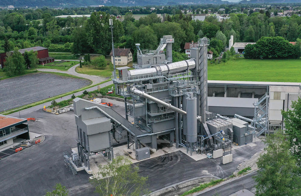
Surveying and scanning has become an essential part of quarry operation, not just for blast design work, but also to produce accurate maps for records and planning purposes. However the addition of GPS and new hi-tech scanning technologies to the equation has added a range of other potential benefits that, as yet, are not being fully utilised by the industry.
"A few top quarry operators use surveying equipment to the full extent but many are only partially benefitting and some are not using the technology at all," said MDL managing director Steve Ball. "The latest techniques have the potential to change the capture and availability of accurate quarry data - it is just a case of interpreting the information correctly." Surveying is mainly used for improving productivity and safety in European quarries. Wider use of scanning lasers has been driven by health and safety - detailed knowledge of the blast face geometry allows the spacing and charge to be designed for safe firing and to save money.
"Twenty years ago surveying was all done by eye and this resulted in deaths, injuries and damage to equipment," said Ball. "Surveying by eye was considered more of an art than a science but an 'experienced' quarry worker only had to make one mistake. Surveying by eye is dangerous because the results are not accurate but modern scan lasers offer both accurate and repeatable results." It is now generally accepted that blasts carried out based on surveyed benches result in neat, tidy and even faces which makes general housekeeping in the quarry easier and benefits safety.
"The problem with surveys comes with the independence of the advice that results from it," said Ball. "Quarry operators undertaking the studies themselves will get the information they need, but there is always the risk with allowing an explosives company to carry out the work that their vested interest in selling more explosives may influence the advice and results." Development in surveying and scanning technology has improved the potential for information to be collected in-house, but quarry operators need to invest in training programmes as well as the hi-tech equipment in order to get the best from it.
"The traditional method of surveying is with total station but although there have been some improvements in long range capabilities, they are only really useful in quarries when used with a prism to extend the range beyond 100m. This also adds the need for a second person to carry out the surveying," said Geo-Konzept department manager Johannes Kutschera.
"They are the most reliable techniques for millimetre accuracy but this type of survey is time consuming, especially for quarries where the shape is constantly changing. They also present safety issues when used with a prism as the operator will have to stand close to the quarry crest during the survey and standing a safe distance away will distort the survey data.
The big breakthrough for surveying in quarries came with the development of lasers in the mid 1980s and more recently with the addition of GPS.
"GPS technology has really revolutionised the capture and storage of data in quarries. This type of survey is accurate to 10 to 20mm which is ideal for quarry applications," said Kutschera. "GPS use has increased in quarries not just because of the wider range of applications but also because it is easier to use than other surveying techniques. GPS can be used to provide basic volume calculations, bench height measurement etc and it is vital for the planning and blast design stages "However, only very large quarries tend to own their own equipment and most surveying is done by contractors. It is generally the lack of understanding of the technology and lack of manpower that prevents these simple tasks being brought in-house. Nonetheless it is important for quarry managers to understand how survey data can be used and captured to ensure the commission the contractor correctly." One of
"Scanning lasers, however, are emerging as the best tool for quarry applications. They are almost a total station but have ranges up to 500m. On their own they are best used for blast design but in combination with GPS they can be used for volume, stockpile and reserve measurements as well as creating new mine maps.
"They are more expensive than a total station at around US$25-30,000 but are highly mobile and could be used in regional group of quarries. There is already a next generation of scan lasers available - significantly more expensive at US$100,000 - but they offer higher accuracy and ability to measure more things such as the dip and strike of the rock and provide slope monitoring capabilities.
"Scan lasers also have safety advantages as they can be operated away from the live quarry face and work can continue during the scanning process. The automation also makes the survey faster - one site could be completed in five hours." Nonetheless, the next development for quarries is Lidar - Light Detection And Ranging - which is a high speed laser system developed for the military. MDL has just launched a civilian version called Dynoscan in the form of a pod that fits onto the foreman's site vehicle and as they drive past the system automatically scans in 3D.
"It requires minimal processing and can be put into
"Changes in the industry have been forced by health and safety but there are huge benefits for cost as it enables accurate records to be kept for regulatory inspectors, planning and auditing. This isn't currently mandatory but it will only be a matter of time before it is," added Ball.
"These kinds of records will allow organisations to keep an accurate track of assets in terms of reserves and stockpiles and will prevent companies from being overvalued through miscalculation or falsifying assets, such as happened with Enron in the US.
"This makes scanning as much of a business management tool as a safety one. It has always been there but is just underused."